Every road’s
got a reason
to stop.
Adventure’s always within cooee.
A free map of the camps, caravan parks, tracks and quiet corners most people drive straight past. Live fuel prices, tides, tonight’s sky, and whether you’ll have a bar of signal when you get there.
Out here a wrong turn costs you two hours and half a tank.
You’d want to know before you take it.
Within Cooee tells you what’s actually at the end of the track before you commit to it. What’s actually there, whether it’s free or you’ll pay, whether you’ll have signal, and whether the sky will be clear tonight.
The good stuff lives in between.
Not at the exit with the sign. Down the track past it, where the map goes quiet and nobody has written a review. That is the country this was built for.
Know what you’re driving to
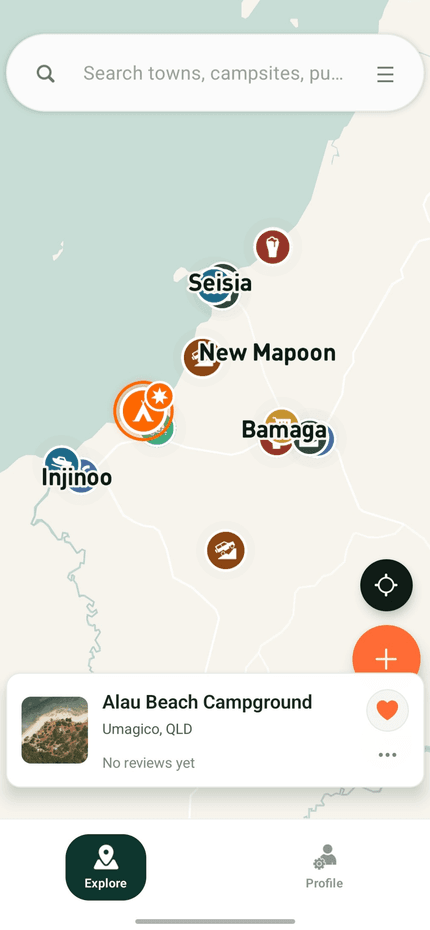
Eight in ten campsites have a sharp aerial view, so you can tell a shaded creek flat from a gravel car park before you turn off. Nearly 2,000 have video filmed by campers who actually stayed the night.
↳ Alau Beach Campground · Cape York QLD
 7,700
7,700 2,700
2,700 6,200
6,200 4,800
4,800 2,100
2,100 2,300
2,300 3,000
3,000 1,500
1,500 +
+Thirty-eight thousand markers
is no use to anyone.
So cut it down. Tap what actually matters tonight and the map redraws around what’s left — free only, dog friendly, somewhere to fill the tank. We’ve confirmed the price on 2,100 campsites so far; the rest fill in as people report them.
Or just ask for it — “cheapest diesel near me” works.
Save a place and its details, photos and a patch of map come with you. It’s still there when the bars run out.
First light, and the beach to yourself.
The tide is right or it is not. You can find that out standing on the ramp at six in the morning, or you can find it out the night before.
Tides, fish and whose rules apply
Boat ramps show the tide for today and the days ahead, what people have actually recorded catching nearby, and whether you need a licence in this state. We don’t restate size and bag limits — they shift, they carry fines, and the fisheries page is the only one worth trusting. So we link you straight to it.
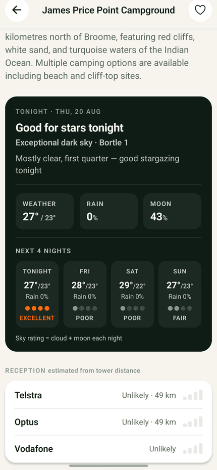
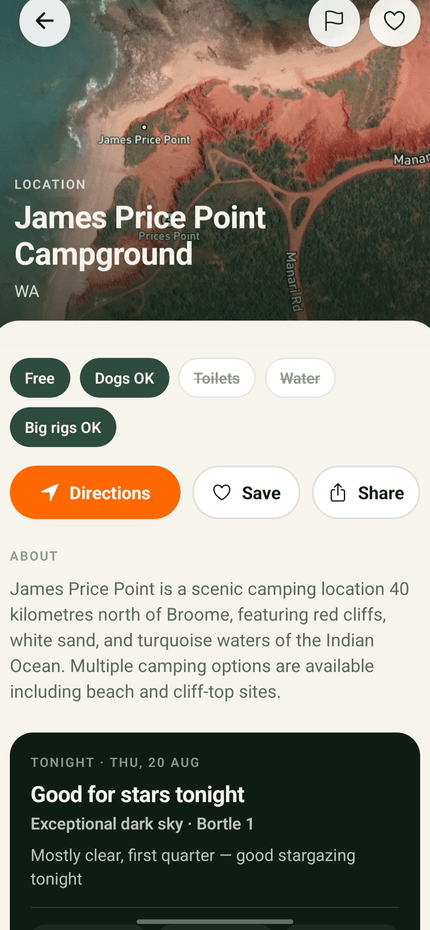
↳ James Price Point Campground · Dampier Peninsula WA
Broome, one afternoon in September. What the app said that day.
Cheapest diesel,
clearest sky.
Live pump prices from government feeds in NSW, Queensland, WA and Tasmania. Ask for the cheapest diesel near you and see what you’ll save against the going rate nearby, not against the dearest pump in town.
Then check tonight’s stargazing verdict, the weather for the next four nights, and how likely you are to have a bar of signal before you commit to the drive.
Australia changes
with the season.
Wattle going off around Ganguddy. Humpbacks working their way up the coast. Wildflowers three months out west. A sky that is worth staying up for, but only on a clear night in the dark half of the month.
Within Cooee doesn’t just know what’s there. It knows when it’s worth going.
Seasons come from iNaturalist observations near each place, corrected for the fact that more people go looking on long weekends than on wet Tuesdays — so a real peak isn’t confused with a busy carpark.
Wattle is flowering.
The worst thing a
camping app can do
is be confidently wrong.
Tell someone there’s water when there isn’t and they ration for nothing. Tell them a track takes a caravan when it takes a boat, and they can’t turn around.
So Within Cooee shows you where each fact came from and when it was last checked. “Toilets — OpenStreetMap, checked March 2024.” Straight from the National Parks asset register, or from a mapper who stood there. A ten-year-old note and last month’s survey are different things, and you deserve to know which you’re reading.
And if we can’t say where something came from, we don’t claim it. Blank beats wrong. Every other camping app shows you a tick with no explanation and no date — that’s why you stop trusting all of it the first time one is wrong.
↳ Sources: NSW National Parks asset register · OpenStreetMap · state government fuel feeds
Built by a camper,
not a corporation.
I got tired of clunky, ad-filled apps while trying to find somewhere decent to pull up for the night. So I built the one I wanted.
No banner ads. Your location stays on your phone — it isn’t sold to anyone. Most of the map is open government data and OpenStreetMap, corrected by hand as reports come in.
The best night of the trip is usually the one you didn’t plan.
Thirty-eight thousand places to have it, and the one you want is a few taps away.
Get out there.
Adventure’s always within cooee.
Marker wrong, or a camp we’re missing? hello@withincooee.app